Well with a google map and a gps we got all turned around and almost ended up in calico
made it to slash x way late and was going to run late on daylight
a few of us took the street plated bikes back to camp to get the trucks and back to slash x to grab everyone else.
ended up at 54 miles of dirt for the whole group and 41 miles of pavement for myself and 3 others.
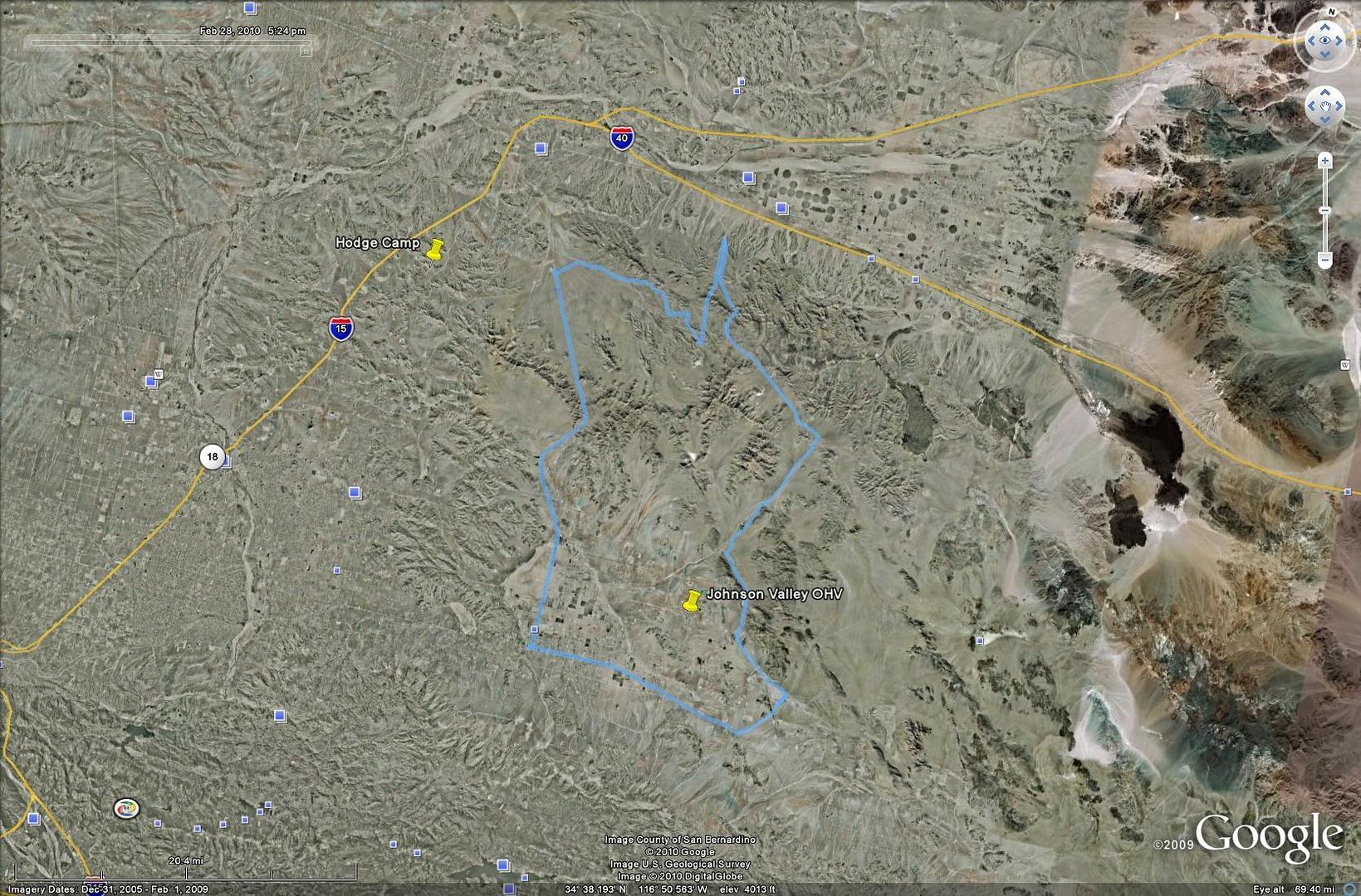
the guy with a gps just sent me a layout of our ride via google earth.
the bottom right of the blue tracking was where we started and the top left of the blue tracking is where we originally wanted to end up at.
you can see our "OH, we went too far North" turn around spike at the top middle
we were out riding so it wasnt all that bad.


 "the game of life of is not so much in holding a good hand as playing a poor hand well"